


OpenStreetMap and Discussing Street Redesigns
*Our recent meeting was a two topic-event divided between software tools and civic engagement

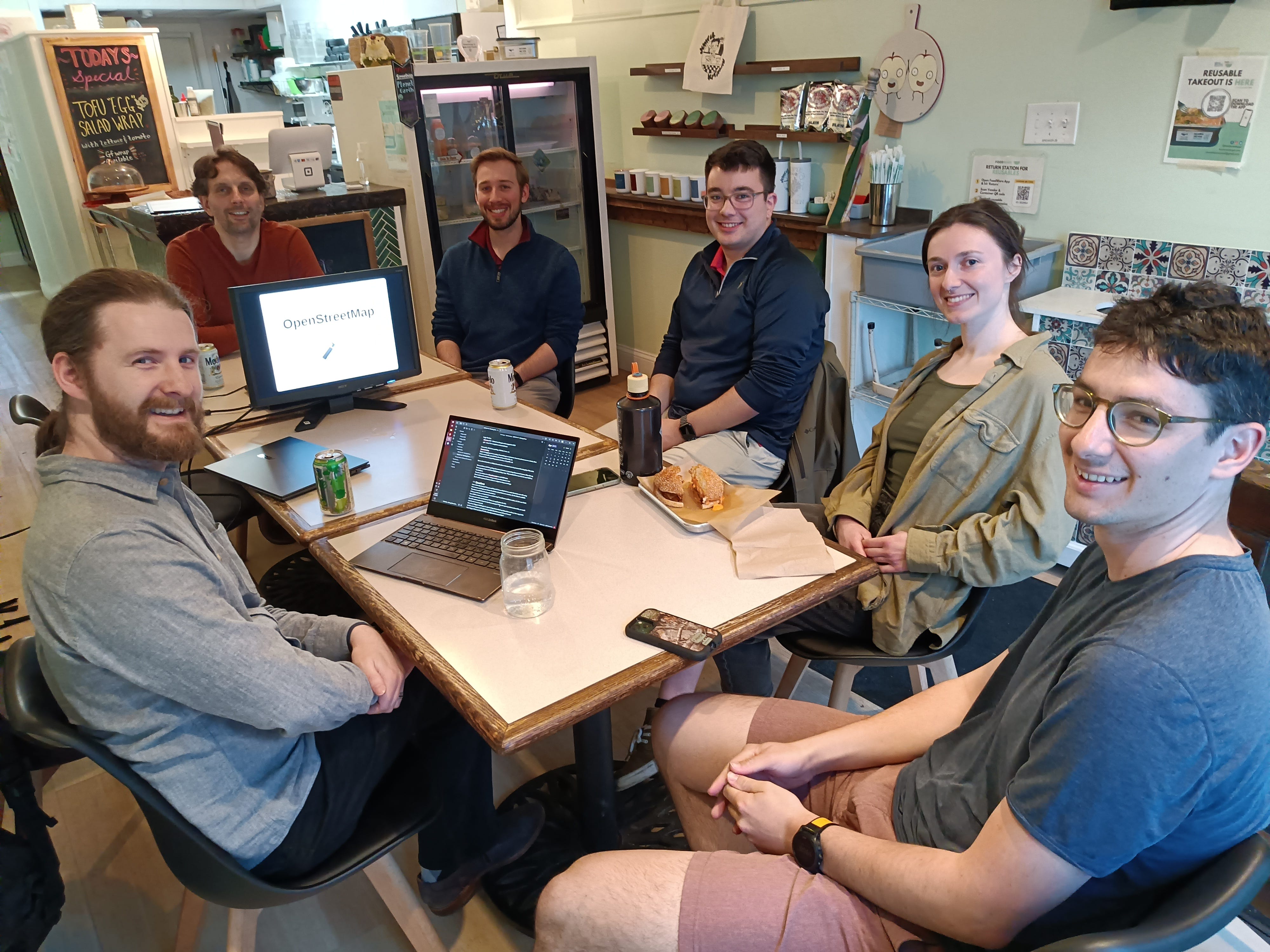
In our most recent meeting Dan Krol gave a presentation on OpenStreetMap (OSM) and its many uses, and Eric Leaver put together a list of streets in Dover that have upcoming repaving projects. Our goal with the former is to potentially use OSM to capture useful data that we can then use in our projects. The goal with the latter is to get in front of these projects and make proposals to the City of Dover on potential redesigns. There is a lot to cover here, so let's get started.
Wikipedia for Maps
At first I thought that OSM was going to be an alternative to Google Maps, and while I suppose you could use it for similar tasks after this presentation I don't think that is the goal of the project. OSM is trying to be a sort of Wikipedia for map data by crowdsourcing the data entry process. In the same way that Wikipedia has editors; so does OSM and anyone can sign up to become one. Using their tools, you can explore your community and add features that are missing from the map. The data can be really detailed as well, identifying street features, materials, footpaths, bike paths, businesses, even things like how many parking spots are in a lot and if they are public or private.
Using OpenStreetMap
OSM itself is more like a database, but it is publicly accessible and software developers can access it to build their own mapping applications. Organic Maps is an offline hiking and biking trails tool that has done exactly that.
A few thoughts on how to leverage something like this come to mind, primarily being able to capture data from around our communities and displaying them in a way that is useful or compelling. We could, for instance, show where all of the current bike lanes or bike parking locations are in the region and identify gaps in our network. Mapping out data is useful for our group, just last fall we used a custom Google Map to highlight graffiti around Dover and sent it to the Graffiti Management Committee for cleanup. I'm thankful to Dan for his effort in this presentation and will be keeping OSM in mind for future projects.
Upcoming Street Redesigns
At our March meeting we discussed the Bicycle-Friendly Streetscapes Guidelines that the City of Dover is working to put into practice. That document details the city's plans to use the regularly scheduled maintenance of repaving and restriping streets as an opportunity to redraw them with an added consideration for cycling. To take advantage of this idea, one of our group leaders, Eric Leaver, put together a presentation of key street sections that are scheduled for such maintenance during this year and our group discussed some potential designs that we will be bringing to the city. A total of 24 street sections will be repaved in the coming year. Eric identified 9 for bicycle-friendly repainting, and we managed to discuss 5 at our meeting. For the sake of brevity in this newsletter, I will cover only one of them in detail.
Silver Street Redesign
The Silver Street roundabout is going to be repaved, and this is a good opportunity to make this section safer and easier to navigate for cyclists and pedestrians. This specific roundabout needs to have very clear communication for cyclists, because there is dedicated bicycle infrastructure on both sides of it, and the other exits lead to non-bike friendly road paths, such as Highway 16. We want to be able to tell cyclists which exits are good for them and which ones to avoid.


At the moment our two separate cycling investments are disconnected because of a confusing roundabout that is intimidating to anyone outside of an automobile. To bridge this gap we need to clearly communicate what cyclists need to do when they arrive at the roundabout. The "Bike Lane Ends" sign terminates the bike path here, so where should a cyclist go? Perhaps the concrete ramp leading to the sidewalk is an invitation to use that path, but riding a bike on sidewalks is illegal. Maybe the bikes should join the travel lane, but the solid white line discourages that choice. We can do better.
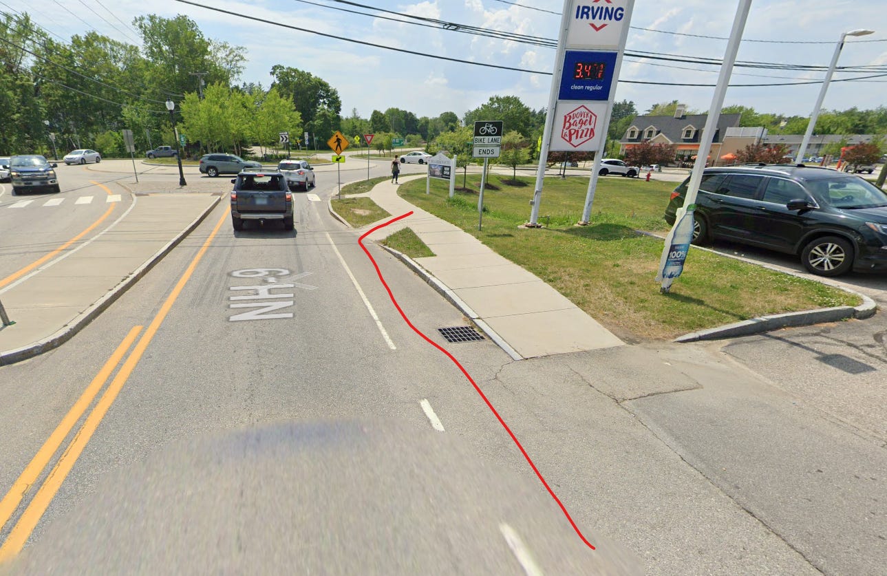
With some paint and sharrows we can mark the roundabout as the appropriate path for cyclists and indicate which exit is safe to take for them.
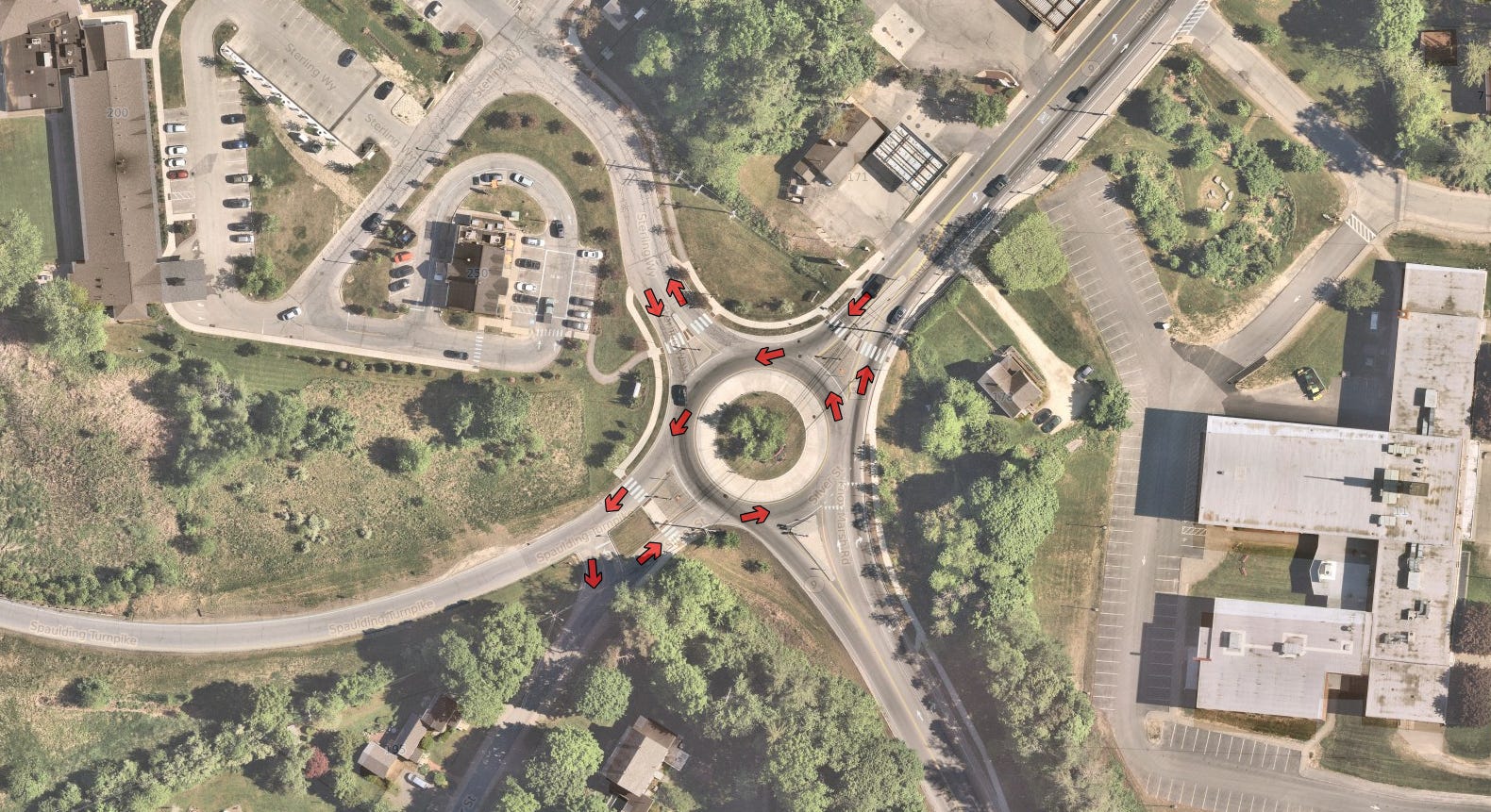
There's one more problem here though, at that is the slip lane coming into the roundabout from Knox Marsh Road.

Slip lanes can be found in lots of places and they are built to make sure that automobiles can take turns at higher speeds. This is not a safe practice, and broadly speaking we should seek to eliminate them from our streets in all such cases. This particular slip lane happens to be next to a crosswalk that is a path to a school. We should use this repaving opportunity to remove this slip lane and improve the safety of the crosswalks it feeds into.

The purpose of a roundabout is to slow everyone down to allow negotiations for the right of way. This is one of the reasons that makes them safer options than traffic lights, and adding slip lanes to a roundabout defeats this safety benefit by allowing certain lanes to skip negotiations and go straight through with just a gentle tap on the brakes. Removing this slip lane restores the roundabout's full function in slowing down traffic so that everyone can safely navigate the intersection.
Is There a Missing Process?
So, we have a plan for changing the Silver Street roundabout and the project is coming up soon. With Dover's efforts in writing up their Bicycle Friendly Streetscape Guidelines document, there should be some way for the community to weigh in on the upcoming redesigns that will result from that. At the moment, though, there doesn't seem to be an area in the public forum where these changes are presented or discussed. Cities don't redesign streets willy-nilly, there is planning involved and a design will be made before any changes happen. Is Dover missing a process here to obtain community input for these designs or are they intending on adding one as a part of this new effort?
Strong Towns Seacoast proposes that the Transportation Advisory Commission (TAC) take on these conversations and provide a place for the public to engage with the redesigns. The TAC can present the designs, discuss them with present community members and vote to recommend them to the city council or appropriate body. There needs to be some way to let people influence the design of their streets and this is our suggestion.
Conclusion
Silver Street is just one of the four streets that we looked at to collect feedback. There are still more to look at and we want to find a good path to bring this information to the city. Establishing a clear process for the community to engage in when it comes to street design would be a win for any city or town because streets should be serving our communities, not just traffic. There is more to a street than just efficient movement for automobiles, and Strong Towns Seacoast wants to bring that message to this region.
If you are enjoying our newsletter, we would love to have you in our new Discord server! We discuss even more Strong Towns topics and are trying to have our conversations held in areas where more people can join in.