03/10/2025 Meeting Recap - Reviewing Dover's Bike Network Guidelines
We were fortunate enough to receive a draft copy of Dover's "Bicycle Friendly Streetscape Guidelines" and reviewed them at this month's meeting
At our most recent meeting we looked over a draft document that was provided to our group by the City of Dover and I am very thankful that they shared it with us prior to public release. Because we received the draft version, I will not be sharing the document itself in this article, but will add it here once the city has finalized it. I'd like to give a special thanks to Erin Bassegio for supplying us with this document as well as Dover Department of Planning for putting it together.
A Point of Confusion
In the Transportation chapter of Dover's Master Plan it lists out several points where bicycle infrastructure is meant to be a goal. Initially, we thought that the document that we would be looking at would be concerning Connectivity goal C 3 and its sub objective C 3.1 (page 44).
Action C 3.1: Prepare a citywide bike plan that identifies existing gaps, determines recommended routes with specific treatments and amenities, and establishes an implementation strategy, including the location and supply of bike racks.
However, this was a confusion on my part and the document that we reviewed was not meant to serve that purpose. Instead it is designated as targeting the Traffic Calming Objective TC 3.1 (page 46).
Action TC 3.1: Implement a policy that evaluates the possibility of restriping City Streets during the routine paving/maintenance to incorporate bike lanes or sharrows before the work is performed.
This is good work that is moving the needle in the right direction, but there remains objectives within Dover's Master Plan that are still being worked on and will help in broadening viable transportation modes. So, don't think that this document is supposed to solve everything. It is a set of guidelines with a smaller scope that helps identify opportunities in regular maintenance to improve traffic calming and expand a safe bicycle network. Though, there is still more work to be done in defining a broader, detailed bicycle network that is integrated into the city's transportation system.
Bicycle Friendly Streetscape Guidelines
The goal of this document is to describe a set of guidelines for different types of transportation infrastructure and is specifically meant to be applied to repaving or restriping efforts. Some of the ideas in here can be implemented within a year or two since street restriping happens pretty often, but I think others could take significant time due to the proposed change being a more involved redesign of the street. This is actually a great idea and should cost the city very little, while creating more space for safer cycling. Moving the location of a painted line can make a big difference in driver behavior, and let's us reconfigure our streets during routine maintenance.
The document's primary approach in establishing its recommendations is to list out the classifications of street types that the city recognizes (arterials, collectors, and local), then list a few variations of each to describe what types of bicycle infrastructure are appropriate for them. An examples of this would be for an arterial that is 80' wide, recommending two 10' travel lanes in each direction and 6' bike lanes in each direction, and they even go on to suggest several areas where these guidelines can be applied.
Using Paint Effectively
Since this document focuses heavily on using paint to create new street designs, I think it is appropriate for us to deliver feedback on how to get the most impact out of that effort. Some of the provided recommendations are not in line with how we think a Strong Town should be approaching these redesigns, and we have some additional recommendations of our own.
Travel Lane Widths
For the various forms of infrastructure there are recommended travel lane widths that range from 10' to 12' wide. This is an improvement because we currently have sections around Dover where travel lanes are 14' or wider and this makes it clear that those widths are no longer acceptable. That said, the document recommends 12' and 11' lanes on "collectors", and that is too wide. A 12' wide travel lane is what the interstate system uses and can comfortably support high speed traffic. This leads to motorists driving at speeds that are typically higher than posted speed limits. Plus, these types of streets typically have less overall width to work with for reconfiguring and narrower travel lanes let's us use more the existing infrastructure for traffic calming purposes.


Our recommendation is to target 10' wide travel lanes, and only go up to a maximum of 11' if there is a clear use that justifies it. We need to eliminate the highway-sized travel lanes in our neighborhoods and streets.
Sharrow Placement
Many local streets in Dover are recommended to receive sharrows along them because there is not enough space for dedicated bicycle lanes. This makes sense, however there is much debate on how helpful sharrows really are for increasing safety and for encouraging cycling. Sharrows are meant to designate a sharing of the travel lane between vehicles and bicycles while giving the cyclist a specified location within the lane to travel. The idea is that these two forms of transportation will be given equal access to the travel lane, and the sharrow will signal to drivers to be aware and patient with cyclists.


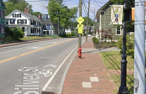
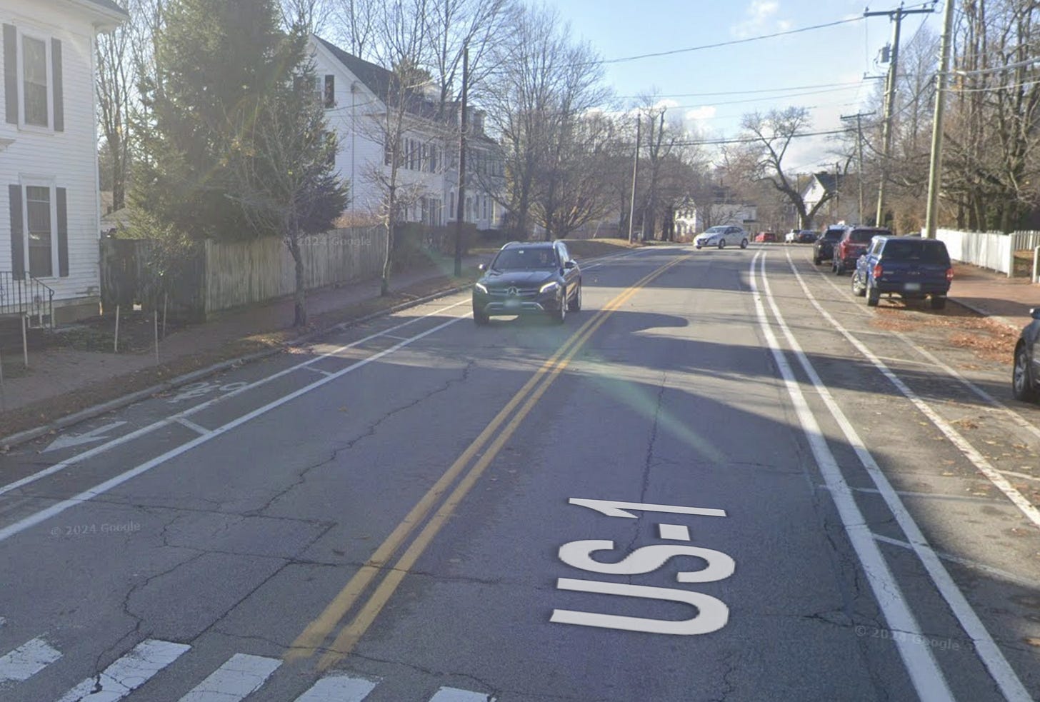
There are areas where this strategy works and others where it doesn't. Because of this we wanted to suggest that dedicated infrastructure is preferred and sharrows should not be considered a quality substitute. Also, if the city is going to place sharrows on streets consider where to place them within the lane because its location is an indicator of where cyclists should be safest. Simply pushing them all the way to the curb like they are placed on Silver Street is easy for drivers to just ignore. For some streets, placing them in the center of the lane is a clearer indication to drivers that they are driving in a shared space.
Our recommendation is to use reserve sharrow use to areas where it is appropriate for a cyclist to take the full width of the lane and to place sharrows in the center of the street to indicate that.
Buffers Please
Since this document focuses only on using paint to redraw our streets, there is no mention of protecting bike lanes with something like bollards. There is unfortunately also no mention of buffers anywhere, and that is something that we would like to recommend. Buffers are achievable with paint and can put an amount of space between the travel lane and the bike lane, making it safer for cyclists. This is especially true in areas where you have higher vehicle traffic volume and vehicle speeds.

When you have speeds of 30mph or higher for vehicles, bikes cannot keep up with that and this makes any kind of collision very dangerous. Having a 2' or 3' buffer as a separator gives more room between the two incompatible speeds and both decreases the risk of collisions as well as increasing the comfort of cycling.
Our recommendation is to use buffers for bike lanes that are near 30mph+ vehicle traffic and to help increase distance between dangerously incompatible speeds.
Wrapping Up
This document captures some ideas that I've had as an approach to remapping the city with bikes in mind. Taking advantage of the regular restriping maintenance to redraw our streets with narrower lanes and more varied uses is a cost effective and non-intrusive way of going about building new intent within our transportation system. I hope that Dover actively takes up these guidelines and we begin to quickly see the results, but I do think there is still room for improvement on the recommendations. When the final version is published, we will take our collected feedback to the city to help them identify these areas and hopefully create a more impactful policy. Streets should not belong to cars, and there is so much potential to be gained by simply moving a few lines of paint around to acknowledge that fact.


